
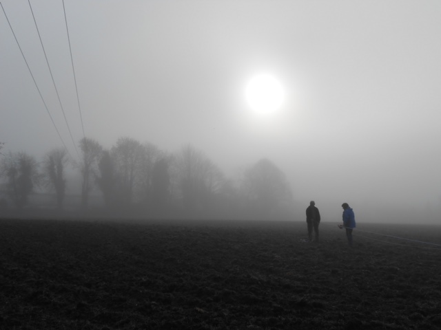
What is field walking?
Field walking is a quick way to access whether there might be human activity on a field. This ‘field’ could be large or small; It could be anywhere or on any type of land; It could be in a valley, on a hillside, or at the edge of a cliff over looking the sea. The field may form part of a site that has been recorded in documents or on maps; or a site that is so old the only evidence of it is what lies on the surface of the soil. In essence, field walking gives us a tantalising clue to unlocking the potential of lost history. What is field walking? It is the art of picking up anything that is not of natural origin from a field surface.
Why field walk?
Whether you’re an archaeologist, or a detectorist; or simply just curious, field walking is a useful precursor to understanding a site before investing time and effort into a project that might not bear fruit. The results of a successful field survey will focus your efforts on the most productive areas of a field; the ‘bit(s)’ that will yield the best results and inform any further work; or otherwise deter you from wasting your time.
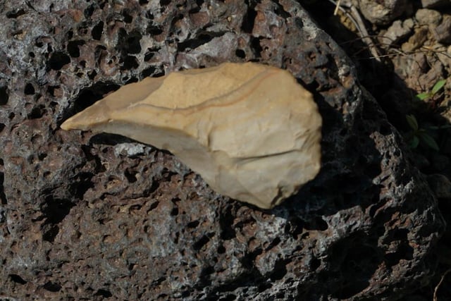
Example:
For example, you have permission to dig a 100-acre field that is rumoured to be in the vicinity of a lost Roman Villa. There is no sign of anything on your field, but years ago a detectorist discovered an enormous Roman lead cistern, which the farmer dug out with a JCB. He only roughly knows which part of the field it came out of and there was no archaeology done at the time to assess whether the cistern was discovered in an archaeological context. The detectorist didn’t share any other finds from the field with the farmer, so he doesn’t know what or if anything else was discovered to help date the cistern.
The field is dead flat; there is no lidar or other survey evidence, no lumps or bumps that might suggest an archaeological site; and finding a location to sink a decent test pit in 100 acres is like finding a needle in a hay stack. Detectorists waste hundreds of hours detecting enormous fields, finding next to nothing, when they could actually spend a few hours field walking and find out all they need to know before getting their detector out and focussing their efforts on a ‘hot spot’. What do I mean by ‘hot spot’? I mean, the ground will be ‘hot’ and buzzing with activity with lots of iron signals, suggesting human activity, which makes it ‘hot’ as in ‘productive’.
How to field walk.
There are several ways to survey a field. Obviously, it is better to do this as a group, rather than as an individual, because you will cover more ground, but as an individual ‘scoping’ a field will still produce results. The best time to field walk is on a cloudy day after a short shower, as this brings the field surface into clarity. Ideally you would wait a few weeks after ploughing or until the ground has been cleared after harvest.
Many detectorists advise a ‘Union Jack’ approach to detecting a field for the first time; that is to detect around a field boundary and then in a ‘cross’ pattern through the centre of the field. But when you have a huge field, this method could easily miss areas of potential within the field. Remember, it is very unlikely that modern field boundaries (especially in the south east of England) will bear any resemblance to older field patterns. Try this approach instead, with or without a detector. Starting at the centre of a boundary line, explore along 20-30ft rows in a trajectory which will take you diagonally across the field. Make 4-6 passes backwards and forwards in transect to the diagonal, collecting everything you find. Plot the location on a map or with a GPS app. and put all the finds in a bag marked 1A for the first transect, 2A for the next, and so on etc. When you go back the other way, the bags will start at your end number and be suffixed with a ‘B’. Each time you finish a transect move at least 20ft along the diagonal before you begin the next transect. This should identify any areas of activity. If you pick up a lot of pottery of one period, say Roman, or Medieval, then you can be certain that there is a density of activity from that period in a particular part of the field, and focus your further efforts and research on that area.
In principle, archaeologists are doing the same thing, but will take a more scientific approach because they are required to report their findings. The prescribed approach is to grid out a field using string line and markers in 10m-20m sections. Each grid will be numbered and GPS co-ordinates recorded. Each participant in the field walking session will be given a grid and between 5-10 minutes to scour the surface and collect and bag any material they discover. Archaeologists work off the basis, as above, that densities of identifiable material relate a single location to archaeological activity beneath the surface of the soil.
A linear approach can produce faster results, requires less equipment, and doesn’t need any precise and time-consuming marking out, rather start and end points for participants will be located at 10ft intervals along opposing boundaries. Each participant walks in a line across the field parallel to a specified boundary collecting material as they go. Finds are bagged and marked 1A from the starting point; 3A for the adjacent participant and so on. The centre of the field is the stopping point and line 1A becomes 1B. At the end of the line, the participant walks back on line 2B, swapping bags at the centre for 2A. At the end of each walk up and down, all the participants move up the boundary to the next set of markers. In this case densities show up when the finds are recorded, so a lot of Roman finds in bag’s 4B, 5B and 6B would suggest Roman activity in roughly that area of the field.
Processing Finds.
Once field walking is complete, each finds bag should be properly processed, that is; the finds should be thoroughly washed and rinsed in water, allowed to dry properly, sorted, identified and recorded as is appropriate to the project. Once the data has been collected, it should be possible to map the ‘hot’ spots and identify each period of activity discovered on the surface.
Conclusion:
Field walking and ‘scoping’ really works and is an efficient way to discover otherwise unrecorded archaeological sites, or sites of detecting interest. There is a lot more information available about the various approaches to field walking on the web, as well as various booklets identifying pottery and flint in PDF form. The PAS website also has some useful guides to identifying period objects. Please remember to show anything of interest to the appropriate Finds Liaison Officer, and please make sure you have the landowner’s permission. Good luck out there!
Lady Donna Martin








Leave A Comment